Navigation 2023

Rare prints and maps...Since 1918! Click here to go to Darvill's home page.

Since Adirondack Retro acquired Darvill's Rare Prints in August of 2022, we have been working tirelessly on our New State-Of-The Art Website. We are excited to announce that it is now up and running and that our massive inventory of Antique Prints and Rare Maps are being transferred over to the new site daily. In addition to the nearly 500,000 prints found on www.DarvillsRarePrints.com, Adirondack Retro offers an eclectic selection of Antique and Vintage Advertisements along with their Limited Edition Giclee Prints. During this transition, customers will still be able to shop and make purchases on www.DarvillsRarePrints.com.

Sign up for our Mailing List and receive our Adirondack Retro Newsletter. When you sign up, we will email you a coupon code for you to get 15% OFF your first order at AdirondackRetro.com.


Taylor and Skinner's Maps of the Roads of Ireland
(First Edition, published in 1778
)
Original 240-year-old copperplate engravings
Sheet size: approx. 5 1/2 x 9 1/2 inches [map on each side of the paper]

CLICK HERE FOR AN INDEX OF ALL OF THE PLATES ORIGINALLY PRINTED IN THIS VOLUME,
WITH THE IRISH COUNTIES AND PRINCIPAL CITIES AND TOWNS FOR EACH MAP.

BELOW ARE THE MAPS THAT ARE AVAILABLE FROM DARVILL'S RARE PRINTS

CORK (PL 167/168) DETAIL

Detail from one of the maps)

These remarkable and exceptionally rare maps are from the first edition of the first book of road maps of Ireland published in 1778.

Taylor and Skinner had originally been surveyors in Aberdeen, and came to work in Ireland in the late 1770s, before eventually heading west to settle in America. They published a similar work to this one, Maps of the Roads of Scotland and North Britain in 1776.

Financing the Atlas 

Although assisted financially by the 'Commissioners for the Forfeited Estates,' (Scotland) and by subscriptions (mainly from the landed gentry whose names and properties were shown along many of the roads) they nonetheless reported that nearly 1500 copies of their Survey were unsold in 1778, and they therefore had debts still to repay. Probably one reason for their peripathetic activities.

These maps of The Roads of Ireland were commissioned by the House of Commons in Ireland, and contain 289 pages of maps. The index for these detailed maps shows distances in English and Irish miles. The maps themselves show copious topographical details, such as forests, hills, farm land, mills, houses, churches, estates etc. The large houses also give the owners names. There is a subscription and name index at the back detailing every name recorded on the maps. This edition also contains a new large-scale 'accurate' map of Ireland.

Ground-breaking Publication 

Taylor and Skinner's road maps of Ireland (and their books for Scotland, England and the USA) were a phenomenal achievement in their day, although not always a commercial success at the time, as in Scotland, they remain an essential inclusion in any serious collection and an imperative for late eighteenth century research.


(click thumbnail for enlarged view, maps printed on both sides of paper)


PLATE 201

FROM LIMERICK TO GALWAY

PLATE 202

FROM LIMERICK TO ENNIS CONTINUED FROM SIX-MILE-BRIDGE ON P. 200


(click thumbnail for enlarged view, maps printed on both sides of paper)


PLATE 203

FROM ENNIS TO INNISTYMOND
AND TO KILFENORA

PLATE 204

FROM CLARE TO KILRUSH


(click thumbnail for enlarged view, maps printed on both sides of paper)


PLATE 205

FROM KILFENORA TO KILRUSH

PLATE 206

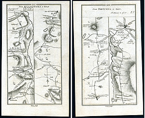
FROM PORTUMNA TO GORT


(click thumbnail for enlarged view, maps printed on both sides of paper)


PLATE 207

FROM BIRR TO KILLENAULE

PLATE 208

FROM BIRR TO KILLENAULE

$50


(click thumbnail for enlarged view, maps printed on both sides of paper)


PLATE 211

FROM GALWAY TO TUAM & DUNMORE

PLATE 212

ROAD FROM GALWAY TO BALLINAMORE

$50


(click thumbnail for enlarged view, maps printed on both sides of paper)


PLATE 213

FROM DUNMORE TO BALLINROBE
AND FROM DUNMORE TO CLARE

PLATE 214

FROM TUAM TO SLIGO

$50


(click thumbnail for enlarged view, maps printed on both sides of paper)


PLATE 217

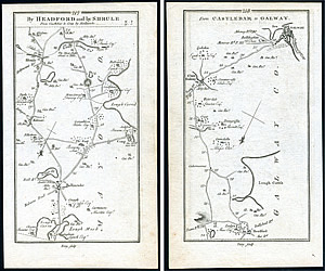
BY HEADFORD AND BY SHRULE
FROM CASTLEBAR TO CONG
BY BALLINROBE

PLATE 218

FROM CASTLEBAR TO GALWAY

$50


(click thumbnail for enlarged view, maps printed on both sides of paper)


PLATE 219

FROM CASTLEBAR TO KILLALA
& CASTLE LACHEN

PLATE 220

FROM BALLINROBE TO SLIGO
BY BALL

$50


(click thumbnail for enlarged view, maps printed on both sides of paper)


PLATE 221

FROM SLIGO TO CASTLEBAR

PLATE 222

FROM SLIGO TO CASTLEBAR

$50


(click thumbnail for enlarged view, maps printed on both sides of paper)


PLATE 225

TO BALLINA

PLATE 226

FROM SLIGO TO BALLYSHANNON
& TO LIFFORD & TO LONDONDERRY

$55


(click thumbnail for enlarged view, maps printed on both sides of paper)


PLATE 227

TO LONDONDERRY

PLATE 228

FROM SLIGO LONDONDERRY

$55


(click thumbnail for enlarged view, maps printed on both sides of paper)


PLATE 229

FROM KILLYBEGGS TO DUNFANAGHY

PLATE 230

FROM KILLYBEGGS TO DUNFANAGHY
FROM BALLYBOSEY TO FINTOWN & SHALAGAN BRIDGE

$55


(click thumbnail for enlarged view, maps printed on both sides of paper)


PLATE 231

FROM LONDONDERRY TO DUNFANAGHY

PLATE 232

FROM CARRICK TO KILLESANDRA
AND TO SWANLINBAR

$55


(click thumbnail for enlarged view, maps printed on both sides of paper)


PLATE 233

FROM GRANARD TO BALLYMAHON

PLATE 234

FROM CARRICK TO BALLYSHANNON
FROM MANOR HAMILTON TO COLOONY

$50


(click thumbnail for enlarged view, maps printed on both sides of paper)


PLATE 235

FROM CARRICK TO BALLYSHANNON
FROM MANOR HAMILTON TO COLOONY
TO THE 5TH MILE, SEE LAST PAGE

PLATE 236

FROM ROSCOMMON TO BALLINASLOE,
EYRECOURT & PORTUMNA

$50


(click thumbnail for enlarged view, maps printed on both sides of paper)


PLATE 237

FROM LONGFORD TO GRANARD,
AND TO ST. JOHNSTOWN

PLATE 238

FROM ROSCOMMON TO CASTLEREAGH
FROM ROSCOMMON TO CARRICK

$50


(click thumbnail for enlarged view, maps printed on both sides of paper)


PLATE 239

FROM ROSCOMMON TO CARRICK
FROM CASTLEREAGH TO BALLAGHY

PLATE 240

FROM BOYLE TO BALLAGHADIREEN
FROM BOYLE TO CASTLEREAGH

$50


(click thumbnail for enlarged view, maps printed on both sides of paper)


PLATE 243

FROM MULLINGAR TO ATHLONE

PLATE 244

FROM MULLINGAR TO TRIM

$50


(click thumbnail for enlarged view, maps printed on both sides of paper)


PLATE 245

FROM MULLINGAR TO KELLS

PLATE 246

FROM TRIM TO NAVAN
FROM ATHBOY TO NAVAN

$50


(click thumbnail for enlarged view, maps printed on both sides of paper)


PLATE 247

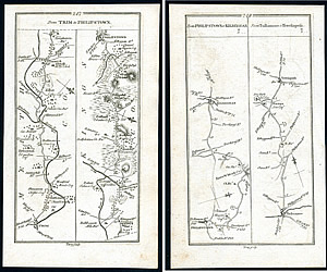
FROM TRIM TO PHILLIPSTOWN

PLATE 248

FROM PHILIPSTOWN TO KILBEGGAN
FROM TULLAMORE TO TERRILSPASS

$50


(click thumbnail for enlarged view, maps printed on both sides of paper)


PLATE 249

FROM CAVAN TO PHILLIPSTOWN
& FROM CAVAN TO GRANARD

PLATE 250

FROM CAVAN TO PHILIPSTOWN

$50

previousnext

1 (Plates 1-50) | 2 (Plates 51-100) | 3 (Plates 101-150) |
4 (Plates 151-200) | 5 (Plates 201-250) | 6 (Plates 251-288)

INDEX OF PLATES